Monday to Saturday - 8:00 -17:30
Gulabi Kantha Trek Garhwal Himalayas India

Overview of Gulabi Kantha Trek.
Trek Location: Garhwal Region Uttarakhand
Duration: 4-5 days
Best Season: All Season (except Monsoon)
Altitude: 3657 mts
Total Trekking: 15 K.M
Difficulty Level: Moderate
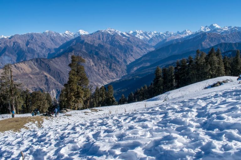
Situated at an altitude of approx 12000 ft above the sea level is Gulabi Kantha. Explorers who have a craze for trekking know that this lush green meadow beautifies the path that leads to Gulabi Kantha. While trekking, one is surrounded with Bandarpunch Peak, Kalindi Sirkala, Shivalik Mountains and Chaukhamba Peak which all lie in the Himalayan range. Even though this gorgeous place offers an adventurous trek, it still lies in the list of the untouched and lesser known trek of the trekking communities of India. The existence of this place intrigued a team of ITBP, Matli (Indo-Tibetan Border Police) to examine the place and decide whether it could be considered for the winter games like Skiing.
Even though this place has not been acknowledged, the beauty of this place lies in the vast variety of flora and fauna and the view of sunrise and sunset over the great Himalayas. Along with this, this place offers a great variety of adventure opportunities for the explorers who come around now.
Route Plan
Dehradun – Hanuman Chatti – Seema Thatch – Gulabi Kantha
Follows the same route for the return journey.
NOTE: Dehradun to Hanuman Chatti (Drive) Original trekking starts from Hanuman Chatti.
If you are reading this then, please send your thoughts in the comment box. Thank you!
Disclaimer: We do not take credit for some of the licensed paid images used in our blogs, whether from Google Images, Fotolia & Shutterstock.
All such images are the copyrights of their respective owners and we try to provide credit for them wherever we can. If, however, any copyright image has been used on our blog, the concerned person can either mail us directly to remove the image or provide credit to whomsoever the image may belong.


